Subject: Indiana, Meteorology
Period: 1853 (published)
Publication:
Color: Black & White
Size:
29 x 19.3 inches
73.7 x 49 cm
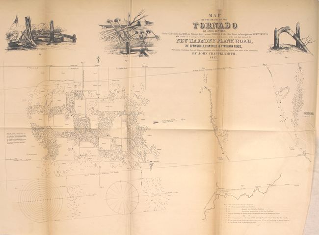
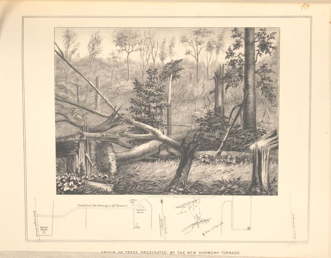
Uncommon and important report and map of a tornado which occurred in southern Indiana on April 30th, 1852. Chappelsmith's detailed study focuses on one square mile of the path of the mile wide tornado. It is impressive in that it shows the fall direction for well over a thousand trees, which must have been a very time consuming task without the aid of aerial surveillance. The map has three illustrations of twisted and broken trees and the report has a full-page lithograph displaying broken trees.
The following is a quote from the Princeton University website on the history of meteorology: "[Chappelsmith’s report was the] first scientific study of a tornado’s path and the first conclusive proof that tornadoes are an inward, upward, and onward moving column of air. In his article, Chappelsmith notes that people living five miles north of the storm continued to plough their fields during the whole time. The tornado’s track was one mile wide and sped from New Harmony to Leavenworth in 1.5 hours, averaging sixty miles per hour and toppling trees at the rate of seven thousand per minute. Primarily based on his detailed examination of these prostrated trees left in the storm’s wake, he concludes that the "phenomena are incompatible with the rotary hypothesis. . . . I am inclined to believe in Professor Espy’s idea of an ascensional column . . ." [pp. 10-11]."
References:
Condition: B
The map is good with toning along the folds, a 3.5" binding tear closed on verso with archival material, and one tiny hole in a blank area closed on verso with old paper. Text and plate are very good with the title below the plate partially trimmed as issued. Bound in modern paper wrappers.