Subject: Wilmington, Delaware
Period: 1953 (circa)
Publication:
Color: Hand Color
Size:
37.3 x 32.4 inches
94.7 x 82.3 cm
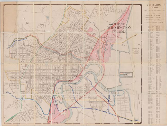
This unique map is based on one designed and published by E.F. Koester in 1939. Although it was originally designed as a street map with corresponding index, this version of the map was used by the Chief Engineer's Office of the Pennsylvania Railroad and updated by hand with track ownership information into the early 1950's. The manuscript legend identifies the tracks of four companies, with the Pennsylvania Railroad dominating the city's railroad network. Manuscript annotations identify other items of interest to the railroad, including rail yards, passenger/freight stations, and rail connections. Dissected and laid down on linen. Self-folds into brown cloth wrappers.
The Pennsylvania Railroad was established in 1846 and by the 1880s had become the largest railroad (and corporation) in the world. It continued to prosper and grow by acquisition through the first half of the 20th century. The Pennsylvania Railroad merged with the New York Central in 1968, resulting in the Penn Central, but the combined company met its demise only two years later. The assets of the Pennsylvania Railroad are now owned by Amtrak and Norfolk Southern.
References:
Condition: B+
Issued folding, dissected and backed with linen. A few panel corners have lifted off from the linen, but the panels are still intact. There is light staining in the top left and right corners due to the adhesive used to attach the cloth wrappers.