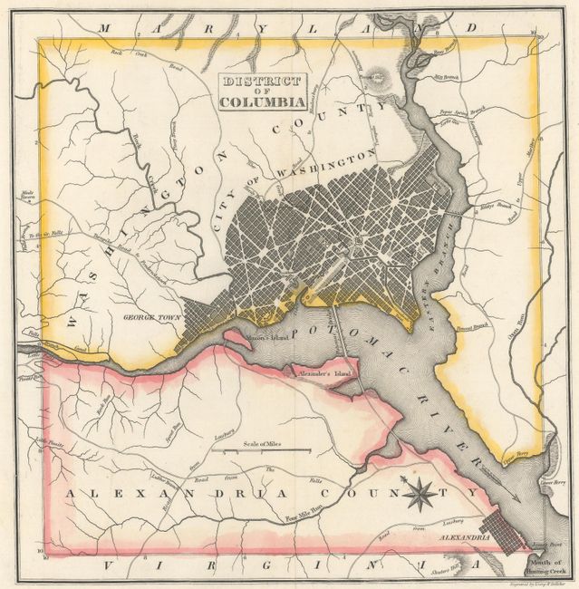
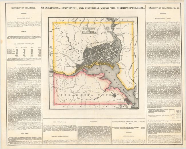
Subject: Washington, D.C.
Period: 1823 (circa)
Publication: A Complete Historical, Chronological, and Geographical American Atlas
Color: Hand Color
Size:
10.4 x 10.7 inches
26.4 x 27.2 cm
This map of the nation's capital is on a full folio sheet (21.3 x 17.1") with surrounding text describing boundaries, climate, population, nearby towns, commerce, government, and history. Washington, Alexandria, and Georgetown are shown as plans, and several waterways and roads are identified. A compass rose capped with a fleur-de-lis indicates that the north is oriented to the upper left and an arrow indicates the direction of the Potomac River. Engraved by Young and Delleker.
References: Phillips (DC) PW #84.
Condition: A
The map itself is clean and bright with contemporary outline color and a faint pencil marking near the center of the map. There are centerfold separations at top and bottom and a few marginal edge tears that have been closed on verso with archival materials. A small chip in the bottom right blank margin has been replaced with old paper.