Subject: Connecticut
Period: 1822 (published)
Publication: A Complete Historical, Chronological, and Geographical American Atlas...
Color: Hand Color
Size:
11.6 x 9.7 inches
29.5 x 24.6 cm
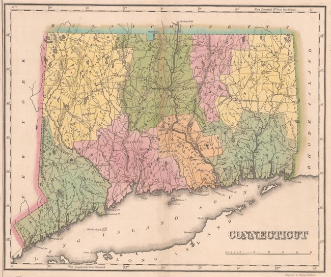
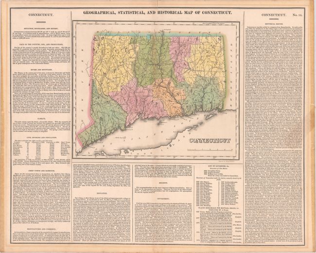
This map was finely engraved by Young & Delleker. It shows the state with a population of only 275,000 as compared to today's number of nearly 3.6 million. Eight counties are named and there is a good network of wagon roads. Norwalk, Fairfield, New Haven, New London, Fort Trumbull and Mystic are marked with flags to indicate "places remarkable for battles, sieges, &c." The map is on a full folio sheet (21.9 x 17.7") and flanked with English text giving a brief description of the state’s boundaries, productions, rivers, climate, chief towns, commerce, education, and religion.
References:
Condition: B
Contemporary color with a short fold separation at top and an edge tear at right that extends 1" into the descriptive text that has been closed on verso with masking tape. There are remnants of tape and light mat burn confined to the margins from a previous framing.