Catalog Archive
Auction 178, Lot 148

"Map of the Territory Annexed to the City of Los Angeles",

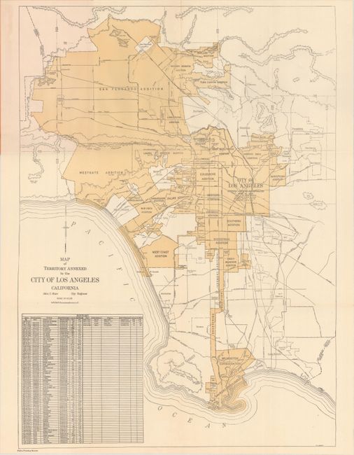
Subject: Los Angeles, California

Period: 1928 (dated)

Publication:

Color: Printed Color

Size:
16.5 x 22.8 inches
41.9 x 57.9 cm
Download High Resolution Image
(or just click on image to launch the Zoom viewer)

A scarce map of the Los Angeles region that depicts the then-present boundaries of the city. It delineates the original square boundary of the city as of 1850 with the numerous additions/consolidations radiating both south and west. A table at bottom left shows the annexation history. Compiled by John C. Shaw, City Engineer and printed by the Police Bureau. Only one past sales record located and one institutional example found on OCLC.

References:

Condition: A+

A fine example, issued folding. There are a few abrasions with minor text loss and light stains to the rear wrapper.

Estimate: $180 - $220

Sold for: $375

Closed on 6/10/2020

Archived