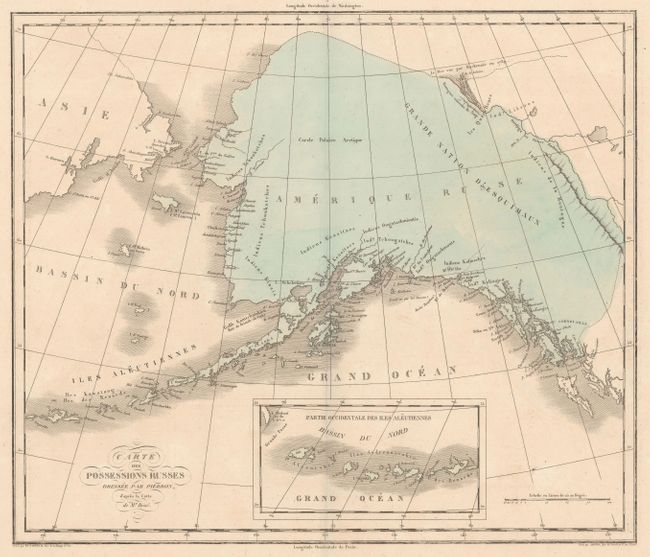
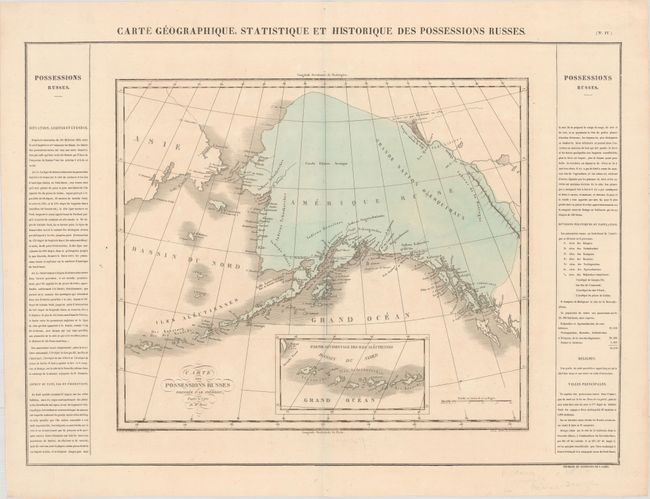
Subject: Alaska
Period: 1825 (published)
Publication: Atlas Geographique, Statistique, Historique ... des Deux Ameriques
Color: Hand Color
Size:
17.4 x 14.8 inches
44.2 x 37.6 cm
This map is similar to those issued in Carey and Lea's American Atlas but is unique to Buchon's French publication. It presents a largely undeveloped Amerique Russe with 8 undefined provinces noted along the coastline. The map spans from Haida Gwaii (formerly the Queen Charlotte Islands) through the Aleutian Islands and incorporates the discoveries of Vancouver and La Perouse. A small inset depicts the far western reaches of the chain. On a full folio sheet (27.0 x 20.9") with French text flanking the map that describes the region, climate, and population. The capital is listed as Sitka, consisting of 60 houses and 1,000 people. Buchon issued his maps on finer paper and they are usually found in much finer condition than his American counterparts.
References: Phillips (Atlases) #1176-4.
Condition: A
Full contemporary color on a bright sheet with a small hole in the top blank margin.