Subject: Southwestern United States
Period: 1855 (dated)
Publication:
Color: Hand Color
Size:
15.9 x 12.9 inches
40.4 x 32.8 cm
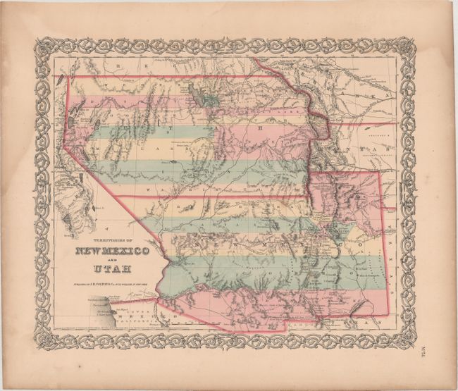
A. Territories of New Mexico and Utah. Second state of this very interesting map depicting the region with the largest configurations of the Utah and New Mexico territories. The Utah Territory encompasses all of today's Nevada and extends west to the Continental Divide into present-day Colorado with Fillmore City as it's capital. Nebraska and Kanzas Territories bound Utah on the east. New Mexico Territory includes part of southern Colorado and stretches west to include Arizona and the southern tip of present-day Nevada. Locates Fremont's routes, proposed routes for the Pacific Railroad, the Cimarron Trail, the Oregon Route 1843, the Spanish Trail, and much more. A fine example of a very desirable map that Wheat found important enough to use as the frontis to Volume 4 of his Mapping the Transmississippi West. This is the more desirable edition with decorative borders from the large two volume atlas, dated 1855 and published in 1859. According to Wes Brown's article in the Portolan, this is the third state (of twelve) with Chihuahua appearing at 31 degrees west of Washington. Condition: There are a few faint spots of foxing and light dampstains in the left and top blank margins.
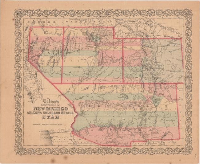
B. Colton's Territories of New Mexico Arizona Colorado Nevada and Utah. This is a rare issue of Colton's great map of the American Southwest featuring the territories shown in transitional states. The proposed territory of Arizona is shown to the south of New Mexico, with New Mexico extending from Texas to California. The newly proposed territory of Nevada is shown taking in the western part of Utah with the border at the 116th meridian, and extending south only until the 37th parallel. The territory of Colorado appears at right. The map locates numerous early exploration routes, mail routes and proposed routes for the Pacific Railroad. Surrounded by Colton's distinctive scroll border. Dated 1855, this was published circa 1860. Condition: Light toning and a few spots of foxing.
References:
Condition: B+
See description above.