Subject: Eastern Canada
Period: 1696 (circa)
Publication:
Color: Hand Color
Size:
18.6 x 23.3 inches
47.2 x 59.2 cm
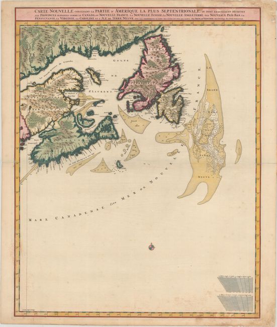
This is the eastern sheet of Visscher's stunning two-sheet map of the Atlantic coast. The sheet covers the region around the Gulf of Saint Lawrence, showing Accadia, Nova Scotia, parts of Quebec, and Newfoundland. It extends to the Grand Banks. The map does not appear to be based on any one source, but it draws from the Coronelli/Nolin map of 1689 as well as Dutch and English sources. While the inland areas of Canada are haphazardly mapped, the coastal areas and the Gulf of Saint Lawrence have been more carefully and accurately delineated. Soundings are noted along the coasts. Distance scales and a compass rose appear in the large unengraved area at bottom. This is the second state with mountains and trees engraved into the landscape with little regard for topographical reality. Engraved by Luggert van Anse. The map has been engraved in a manner that allows it to function as a standalone map or as a unified two-sheet map, with a guideline at left for merging.
References: Burden #731; Kershaw #319.
Condition: B+
A sharp impression with light dampstaining at top and bottom, minor scattered foxing, and centerfold separations at left and right that have been closed with tape on verso. A short tear crosses the neatline at bottom, and some small chips and tears in the top right and bottom right margins have been repaired with old paper.