Subject: Eastern Canada
Period: 1600 (published)
Publication: Thresor de Chartes
Color: Hand Color
Size:
4.9 x 3.4 inches
12.4 x 8.6 cm
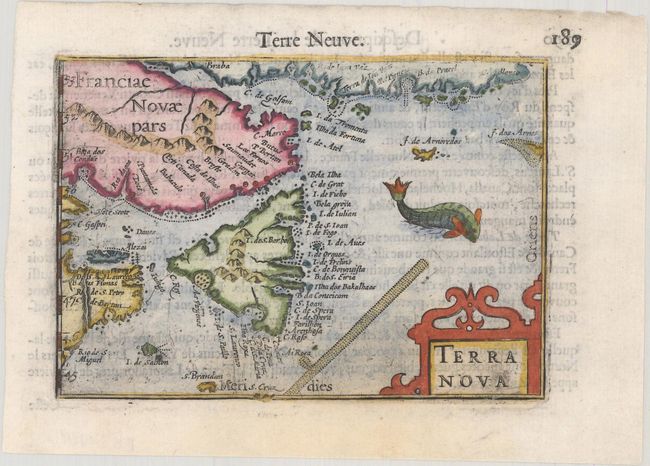
Graphic miniature map of Nova Scotia and the adjacent areas in Canada. The map was directly derived from Plancius' milestone map of the North Atlantic, which depicted Newfoundland as a single island for the first time. A codfish frolics in the sea to illustrate the fishing grounds in the area, and a strapwork cartouche embellishes the lower right corner. French text on verso.
The map was first published by Cornelius Claesz and printed by Barent Langenes in the 1598 edition of the popular Map-treasury. For the 1599 edition, graduation lines and latitude numerals were added to one side of the border on most of the maps, which were again used for multiple editions through 1650. This is the second state with the added graduation lines from a French edition, printed by Albert Hendricks.
References: Burden #113; Kershaw #47; King (2nd ed.) pp. 80-82; Van der Krogt (Vol. III) #9130:341.
Condition: B+
A dark impression on a bright sheet with a light stain at bottom.