Catalog Archive
Auction 177, Lot 76

First State of Wytfliet's Landmark Map of Eastern Canada

"Nova Francia et Canada", Wytfliet, Cornelis

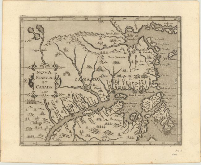
Subject: Eastern Canada

Period: 1597 (dated)

Publication: Descriptionis Ptolemaicae Augmentum

Color: Black & White

Size:
11.3 x 9.1 inches
28.7 x 23.1 cm
Download High Resolution Image
(or just click on image to launch the Zoom viewer)

This map is cartographically significant for a number of reasons: it is the first state of the plate; it was issued in the first atlas of the New World; it is the first map to use Canada in its title; and it is the first map to concentrate on the St. Lawrence River and gulf. The general outline of the map is derived from Gerard Mercator and summarizes sixteenth-century knowledge of the region. The region north of the St. Lawrence and east of the Saguenai River is labeled Canada, and Nova Francia is centered on the town of Hochelaga (present-day Montreal).

References: Burden #102; Kershaw #35; Mickwitz & Miekkavaara #307-18.

Condition: A+

A fine example on watermarked paper.

Estimate: $1,200 - $1,500

Sold for: $2,300

Closed on 4/29/2020

Archived