Subject: Mozambique
Period: 1600 (published)
Publication: Thresor de Chartes
Color: Hand Color
Size:
4.9 x 3.4 inches
12.4 x 8.6 cm
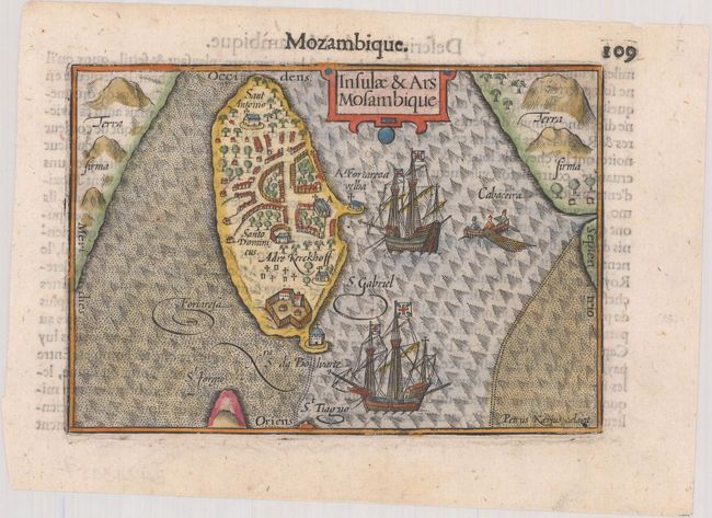
Charming miniature map of an island off the coast of Mozambique with its natural harbor. The partial coastline of Madagascar appears to the east. The island is dominated by a Portuguese fort and town, which housed approximately 40 to 50 families according to the text. A strapwork cartouche, two galleons, and a fishing boat complete the composition. French text on verso.
The map was first published by Cornelius Claesz and printed by Barent Langenes in the 1598 edition of the popular Map-treasury. For the 1599 edition, graduation lines and latitude numerals were added to one side of the border on most of the maps, which were again used for multiple editions through 1650. This is from a French edition, printed by Albert Hendricks.
References: King (2nd ed.) pp. 80-82; Van der Krogt (Vol. III) #8830:341.
Condition: A
A dark impression on a bright sheet.