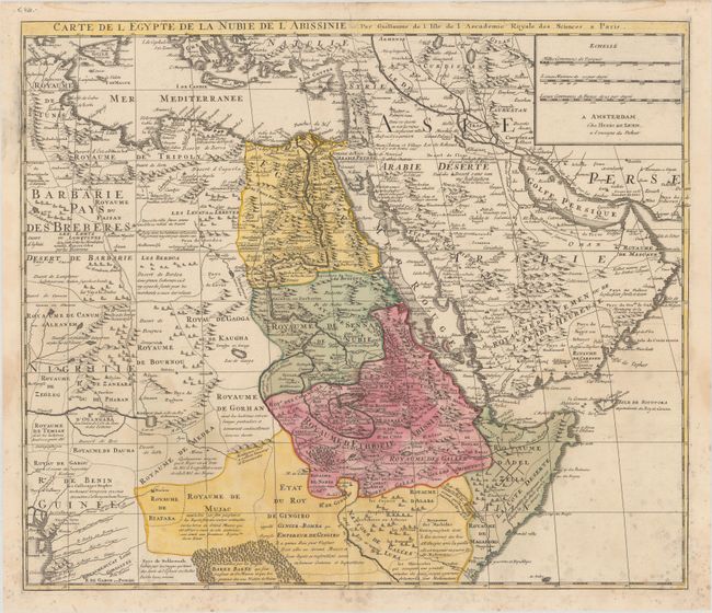
Subject: Northeastern Africa & Arabia
Period: 1750 (circa)
Publication:
Color: Hand Color
Size:
22.7 x 19.3 inches
57.7 x 49 cm
This very detailed and fascinating map of northeastern Africa, the Red Sea and the Arabian peninsula shows the political divisions and kingdoms, roads, topography, settlements, encampments and much more. The Nile originates in the mountains near the L. de Dambee. The map is filled with notations concerning the various tribes, trade routes, and the location of emeralds. This edition was published by Henry de Leth.
References: cf. Norwich #298.
Condition: B+
A crisp impression on a bright sheet with full contemporary color and four matching coat of arms watermarks. There is an archivally repaired tear at top center and some mildew stains at bottom.