Subject: Northwestern Africa
Period: 1738-39 (dated)
Publication: La Harpe's Histoire Generale des Voyages
Color: Hand Color
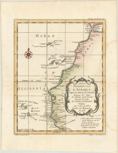
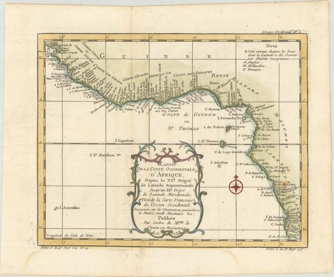
This lot includes two maps that trace the coast of northwestern Africa. Both include a wealth of information along the coastlines, compass roses, and decorative title cartouches featuring leaf and scroll motifs.
A. Coste Occidentale d'Afrique, Depuis le Detroit de Gibraltar Jusqu'au XIe. Degre de Latitude Septentrionale..., dated 1738 (7.8 x 9.8"). This map of the northwestern coast of Africa covers from the Strait of Gibraltar to just below the Cape Verde Islands.
B. Carte de la Coste Occidentale d'Afrique, Depuis le XIIe. Degre de Latitude Septentrionale..., dated 1739 (9.9 x 7.8"). This handsome map depicts Africa's west coast locating many harbors and capes. The map shows the Grain, Ivory, Gold, and Slave coasts and extends south to Angola.
References:
Condition: A
Both maps are crisp impressions on watermarked paper with faint damp stains, a hint of offsetting, and a pair of worm holes in the blank margins.