Subject: Africa
Period: 1759 (dated)
Publication:
Color: Hand Color
Size:
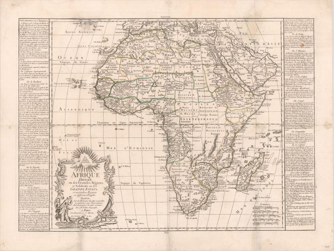
20.5 x 18.2 inches
52.1 x 46.2 cm
This interesting and rare map of Africa focuses on the political divisions within the continent. Place names and topographical details are relegated primarily to the coasts, with the interior still largely unexplored. Adorned with a decorative title cartouche. Panels of French text describe the various nations. Overall size with text on each side of map is 25.75 x 18.5".
References:
Condition: B
A nice impression with contemporary outline color on a bright sheet with the watermark of a Maltese cross encircled with rosary beads. There is light soiling, some extraneous creases, and archival repairs to several separations and small holes along the creases. Two holes along the border at top (a 3/4" hole in the Azores and a a 1"x2" hole in the relatively blank area of the map at top right) have been professionally repaired with a portion of the border and rhumb lines replaced in facsimile, and a small loss of image in the Azores.