Subject: Indian Ocean
Period: 1702 (circa)
Publication:
Color: Hand Color
Size:
21.5 x 16.9 inches
54.6 x 42.9 cm
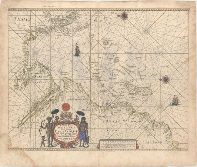
This uncommon English sea chart covers the Indian Ocean between the eastern coast of Africa and India, spanning from C. Bona Esperanca (Cape of Good Hope) to Ceylon (Sri Lanka). It is crisscrossed with rhumb lines and depicts islands, including Islau Renzo (Madagascar), Sri Lanka, and the Maldives. Two sailing ships decorate the ocean. Place names are clustered along the coastlines with no inland detail. Two ornate compass roses orient north to the left. There is a decorative title cartouche featuring the East India Company's coat of arms under the sun with several natives of the region. Three distance scales are enclosed in an additional decorative cartouche. The chart was first issued by John Seller; after Seller's death, John Thornton acquired the plate. It appeared in both Atlas Maritimus (ca. 1702) and The English Pilot. The Third Book (1703). Thornton's son Samuel published a later edition with his own imprint in 1711, and Mount & Page continued to publish the chart sans imprint after the younger Thornton's death.
References:
Condition: B+
A nice impression with light toning, minor soiling, and a dampstain that enters the image at bottom left.