Subject: Colonial North America
Period: 1755 (dated)
Publication: Allegmeine Historie der Reisen zu Wasser unde Lande
Color: Black & White
Size:
13.7 x 10.9 inches
34.8 x 27.7 cm
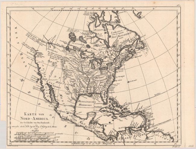
This is a scarce German edition of Bellin's interesting map of North America that illustrates the travels of Pierre Francois Xavier de Charlevoix, a Jesuit who explored the French colonies in North America in the early part of the eighteenth century. The most distinctive feature of the map is the River of the West shown as a definitive waterway flowing west from Lake Superior to the Pacific Ocean near the Berg von glanzen den Steinen (mountain of brilliant stones). The actual northwest coastline is indistinct with notations of the discoveries of Martin d'Aguilar. The Missouri, Rio Grande (Nord-Fluss), and Colorado Rivers all originate near each other beneath a notation to the effect that reports of the kingdoms of Quivira and Taguiao are uncertain. The Mississippi River system and the Great Lakes reflect Charlevoix's travels in the region and reports he compiled from fur traders. Engraved by L. Schenk and J. Soon and published by by Arkstee & Merkus.
References: McGuirk #59; cf. Wagner (NW) #544; cf. Wheat (TMW) #120.
Condition: A
A superb impression on a bright sheet, issued folding on paper with a large Amsterdam coat of arms watermark. There is a binding trim at bottom left.