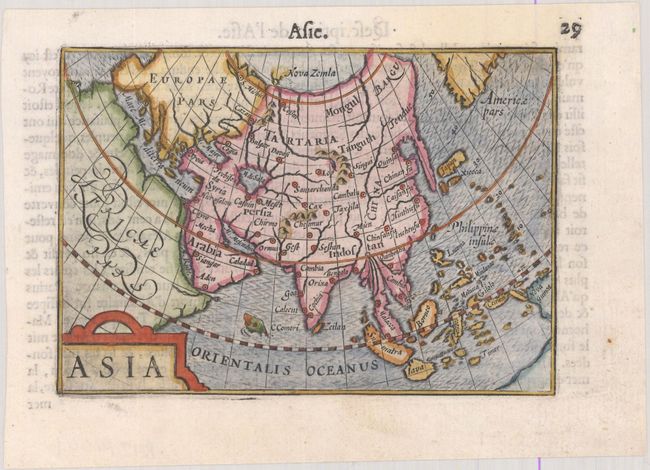
Subject: Asia
Period: 1600 (published)
Publication: Thresor de Chartes
Color: Hand Color
Size:
4.9 x 3.4 inches
12.4 x 8.6 cm
This map of Asia was a bit ahead of its time, with Korea appearing as a peninsula, albeit a greatly elongated one. Most maps of Asia at the end of the 16th century depicted Korea as an island or, more commonly, omitted it altogether. Also interesting on this map is the partial outline of Novaya Zemlya, which reflects attempts to find a northern sea passage to China. Much of the cartography within the continent is quite spurious, including a triangular-shaped Caspian Sea and an unnamed Lake Chimay in southern China with five rivers flowing south. A portion of Americae pars appears at top right, and part of the great Southern Continent is shown in the area of Australia. French text on verso.
The map was first published by Cornelius Claesz and printed by Barent Langenes in the 1598 edition of the popular Map-treasury. For the 1599 edition, graduation lines and latitude numerals were added to one side of the border on most of the maps, which were again used for multiple editions through 1650. This is from a French edition, printed by Albert Hendricks.
References: King (2nd ed.) pp. 80-82; Van der Krogt (Vol. III) #8000:341; Yeo #18.
Condition: A
A dark impression on a bright sheet with a faint stain at top.