Subject: Red Sea
Period: 1804-5 (dated)
Publication:
Color: Black & White
Size:
23.6 x 28.8 inches
59.9 x 73.2 cm
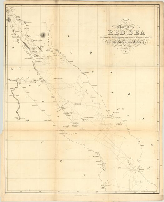
This chart of the northern portion of the Red Sea, the world's northernmost tropical sea, extends from Suez in the north to Port Sudan and Mecca in the south. The sea is filled with the tracks of several vessels including Dalrymple's Swallow in 1776 as well as several shipwrecks. On land, trails lead from Bernice and Cosire to the Nile River, and a note near Tor indicates "3 days Journey for Camels to Suez, here is good water." This is one half of a two sheet map with its own title and borders. This chart was based upon hydrographic surveys of the British East India Company. Engraved by Cooper and published by William Miller in 1809.
References:
Condition: B
Issued folding and now flattened and backed with archival tissue along the fold lines to repair numerous long separations. There is faint offsetting and light toning along the fold lines.