Subject: Holy Land
Period: 1659 (dated)
Publication:
Color: Hand Color
Size:
22.3 x 18.3 inches
56.6 x 46.5 cm
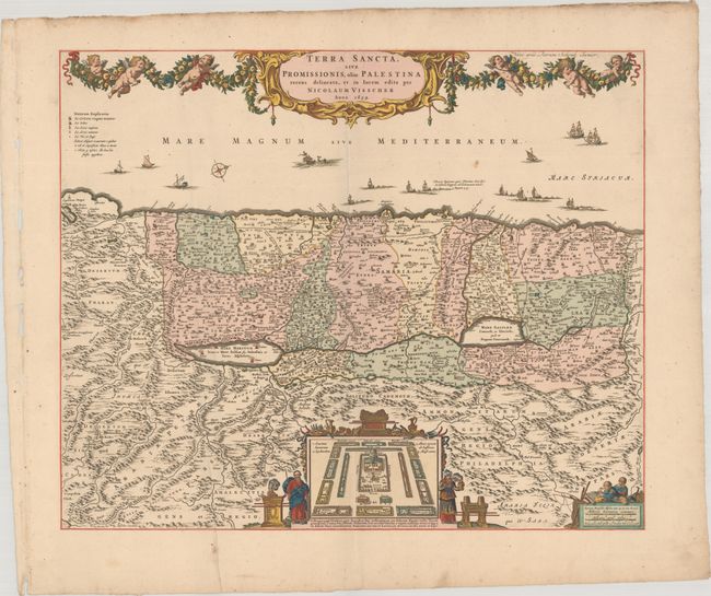
North is oriented to the right on this richly decorative map of the Holy Land. The coast is filled with many different kinds of ships, including one bringing cedar for Solomon's Temple, and another storm-tossed ship with a sea monster that illustrates the Jonah and the whale bible story. The Cison (Kishon) River connects Haifa Bay to the Sea of Galilee. At bottom is an inset of the encampment of the Tribes surrounding the Tabernacle, flanked by Moses and Aaron. The top of the map is decorated with an elegantly engraved cartouche and garland supported by a fleet of putti. The fishermen emblem of the Visscher firm, showing both father and son, is at bottom right. This state adds the imprint of Pieter Schenk at top right.
References:
Condition: A
A crisp impression with a couple small spots and a printer's crease at bottom left. There are several holes in the left margin (where it was bound), well away from map image.