Subject: Colonial North America
Period: 1685-1768 (circa)
Publication:
Color: Black & White
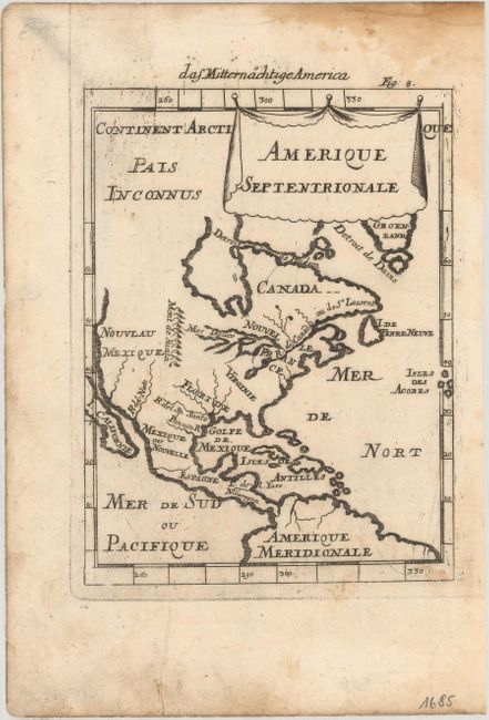
A. Amerique Septentrionale, by Alain Manesson Mallet, published in Beschreibung des Ganzen Welt-Kreisses… circa 1685 (4.6 x 6.1"). This charming miniature map depicts the continent with the island of California shown only to about the 40 degrees north. The Great Lakes are open-ended in the west and called Mer Douce and there is a north-south range of mountains called Mont de Suala. A drape-style cartouche adorns the title. This is the second state of the map, published in the German edition of Description de l'Univers, with German text above the map. References: Burden #563; McLaughlin #81-2. Condition: A dark impression on watermarked paper with some printer's ink residue at top left, a damp stain in the top blank margin, and marginal soiling that just enters the border a bit at bottom.
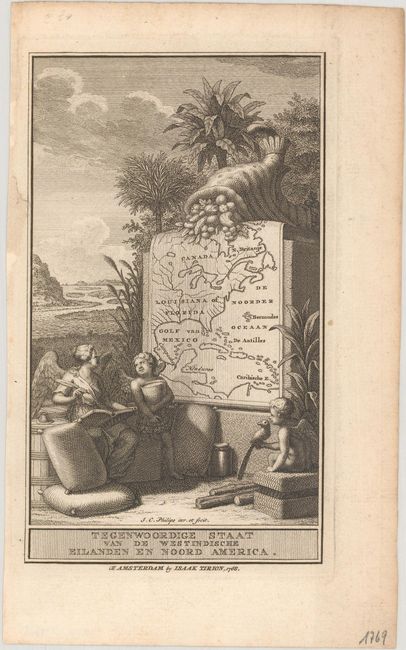
B. Tegenwoordige Staat van de Westindische Eilanden en Noord America, by Isaak Tirion, dated 1768 (3.9 x 6.8"). A small, attractive title page showing a map of the eastern part of North America, extending to the Caribbean. The setting is evocative of the West Indies, with palm trees and exotic fruit shown. In front of the map sit two putti and an angel with trade goods of the region and a parrot. Condition: A sharp impression with an archivally repaired chip in the left blank margin and light toning along the edges of the sheet.
References:
Condition: A
See description above for details.