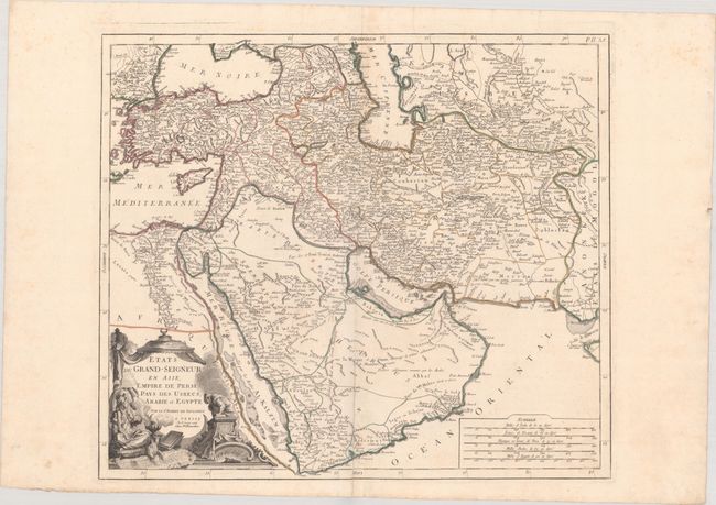
Subject: Middle East & Central Asia
Period: 1778 (dated)
Publication:
Color: Hand Color
Size:
21.7 x 18.9 inches
55.1 x 48 cm
This is the Italian edition of this handsome and detailed map centered on the Arabian Peninsula, here called Arabie Heureuse. The map shows the Black and Caspian Seas, and extends to include modern Turkey, Persia, Syria, Israel, Saudi Arabia, Iraq, Iran (Persia), Uzbekistan, and much of Afghanistan. A Grand Desert is located between Mecca and Oman, today known as the Rub' al-Khali desert. There is particularly good detail on the Arabian Peninsula and the Red Sea. The map is adorned with a decorative cartouche showing a Turkish sultan seated on pillows, smoking a long pipe, and five distance scales at lower right.
References: cf. Ankary #184; cf. Pedley #389.
Condition: B+
A nice impression with contemporary outline color on a bright sheet of watermarked paper with some minor scattered foxing at top and a 4" centerfold separation at bottom that has been repaired on verso with archival materials.