Subject: Eastern Mediterranean & Middle East
Period: 1600 (published)
Publication: Thresor de Chartes
Color: Hand Color
Size:
4.9 x 3.3 inches
12.4 x 8.4 cm
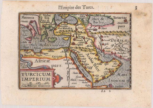
This charming miniature map shows the Turkish Empire stretching from the Balkans through the Caspian Sea and from Northern Africa through the Arabian Peninsula. Although the Red Sea is labeled Mare di Mecca, the city of Mecca is not shown on the map. The Caspian Sea is shown in an east-west orientation. The map is decorated with a strapwork title cartouche and moiré-patterned seas. Blank verso.
The map was first published by Cornelius Claesz and printed by Barent Langenes in the 1598 edition of the popular Map-treasury. For the 1599 edition, graduation lines and latitude numerals were added to one side of the border on most of the maps, which were again used for multiple editions through 1650. This is the second state with the added graduation lines from a French edition, printed by Albert Hendricks.
References: Ankary #40; King (2nd ed.) pp. 80-82; Van der Krogt (Vol. III) #8100:341.
Condition: A
A dark impression with marginal soiling.