Subject: Elba, Italy
Period: 1600 (published)
Publication: Thresor de Chartes
Color: Hand Color
Size:
4.9 x 3.4 inches
12.4 x 8.6 cm
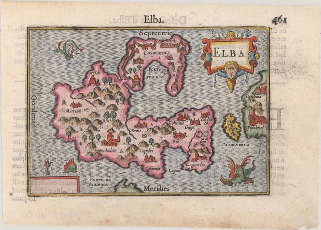
This miniature map of Elba and adjacent islands provides a delightful view of the important Mediterranean island of Elba with graphic depictions of the topography, cities, and the fortification of Cosmopoli (Portoferraio). The coastline of Tuscany is at far right. The map is adorned with a winged sea monster, a mermaid, and an angel above the decorative title cartouche. French text on verso.
The map was first published by Cornelius Claesz and printed by Barent Langenes in the 1598 edition of the popular Map-treasury. For the 1599 edition, graduation lines and latitude numerals were added to one side of the border on most of the maps, which were again used for multiple editions through 1650. This is from a French edition, printed by Albert Hendricks.
References: King (2nd ed.) pp. 80-82; Van der Krogt (Vol. III) #7540:341.
Condition: A
A dark impression on a bright sheet with faint damp stains confined to the blank margins.