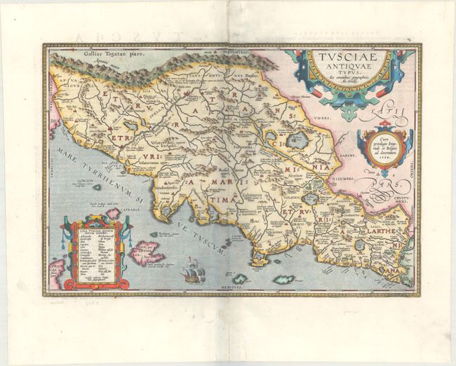
Subject: Western Italy
Period: 1584 (dated)
Publication: Theatrum Orbis Terrarum
Color: Hand Color
Size:
18.8 x 12.6 inches
47.8 x 32 cm
Stunning map of ancient Tuscany based on Bellarmati's map supplemented by classical sources. Includes numerous small islands off the coast, as well as a bit of northern Corsica. Adorned with three strapwork cartouches and a galleon. This is the second plate with the ship sailing eastward, and the second state with the addition of Roman roads. Latin text on verso, published in 1624.
References: Van den Broecke #208.
Condition: B+
A dark impression on a bright sheet with the horn coat of arms watermark commonly found on Ortelius maps. There are professional repairs to worm tracks along the centerfold, with a minor amount of image replaced in facsimile.