Catalog Archive
Auction 177, Lot 501

"Carte de Pologne, avec la Chronologie des Rois et des Ducs de Lithuanie, Ainsi que des Grands Maitres de l'Ordre Teutonique...", Chatelain, Henry Abraham

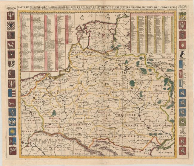
Subject: Eastern Europe, Poland

Period: 1720 (circa)

Publication: Atlas Historique

Color: Hand Color

Size:
23.3 x 19.5 inches
59.2 x 49.5 cm
Download High Resolution Image
(or just click on image to launch the Zoom viewer)

This large map of the Polish Empire covers the region from the Baltic Sea to the Black Sea, extending to Vienna, Austria in the southwest. Dozens of towns fill the map and are listed in a table at top right. At top left are tables outlining the rulers of Poland, Lithuania, and the Teutonic Order, as well as a list of key battle sites. The map is flanked by the coats of arms of the Polish provinces.

References:

Condition: B+

A dark impression, issued folding on a sheet with a large elephant watermark, with light offsetting and minor toning along the centerfold.

Estimate: $275 - $350

Sold for: $375

Closed on 4/29/2020

Archived