Subject: Switzerland
Period: 1953 (circa)
Publication:
Color: Printed Color
Size:
27.8 x 14.6 inches
70.6 x 37.1 cm
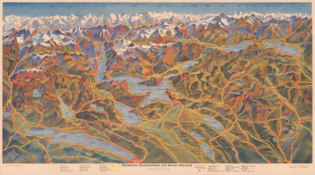
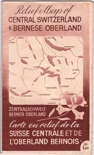
This attractive map of central Switzerland provides a stunning view of the rugged topography and snow-capped mountaintops. Covers the region from Zurich to Lucern and Interlaken with north oriented at bottom. Prominently displays the road network (yellow), rail network (red), and places of interest (triangles). Signed in the plate by C. Kaltenbach and published by Mehrfarbentiedruck, Conzett & Huber. Both the map key and related text on verso are presented in German, French and English. Self-folding into pictorial wrappers (4.8 x 8.8").
References:
Condition: A
A colorful example, issued folding, with a small extraneous crease at bottom and two tiny splits at the fold junctions.