Subject: Western Hemisphere - America
Period: 1704-50 (circa)
Publication:
Color: Black & White
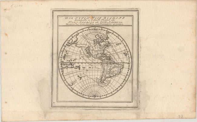
A. Der Neuen Welt Begriff Bestehende in 2 Haubt Theilen als Nord America und Sud America..., by Gabriel Bodenehr, published in Atlas Curieux, circa 1704 (5.1 x 5.8"). Attractive small map of the Americas featuring the Island of California with an indented northern coast and part of the coast of New Zealand. This is the third state of the plate with the added coastlines of New Guinea, Diemens Land, Japan, and Land von Jesso in the Pacific. The depiction of Hudson Bay is odd, with a large landmass bisecting the bay. Reference: McLaughlin #141. Condition: Light soiling and backed in archival tissue to repair several separations along the plate mark.
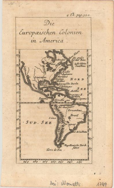
B. Die Europaeischen Colonien in America, Schauplatz d. Natur, circa 1750 (2.8 x 5.2"). This simple miniature map shows North and South America in outline with minimal detail. In North America the British Colonies are identified along the eastern coast with a dotted line with a few states named, while the region to the west is labeled Louisiane. A prominent mountain range is depicted along the western coast of South America, again with only a few place names. Condition: A crisp impression with very light toning.
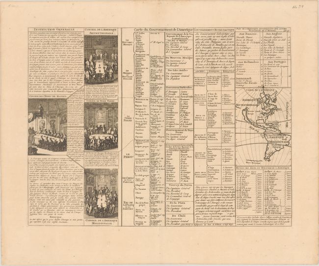
C. Carte du Gouvernement de l'Amerique, by Henry Abraham Chatelain, from Atlas Historique, circa 1720 (17.3 x 13.0"). A folio sheet filled with fascinating French text, statistics and four engravings showing the Council of the Indies dividing up Spanish Empire in America. The map itself (3.7 x 5.2") shows an unnamed island of California on the Sanson model. The only political detail is the division of the regions between the colonial powers. Far to the south, a purely speculative Antarctic continent is suggested as Terre Inconnue. Reference: McLaughlin #164. Condition: A crisp impression with an "ICH" watermark and very minor toning.
References:
Condition: B+
See description above.