Subject: Southern Poland
Period: 1600 (published)
Publication: Thresor de Chartes
Color: Hand Color
Size:
4.9 x 3.4 inches
12.4 x 8.6 cm
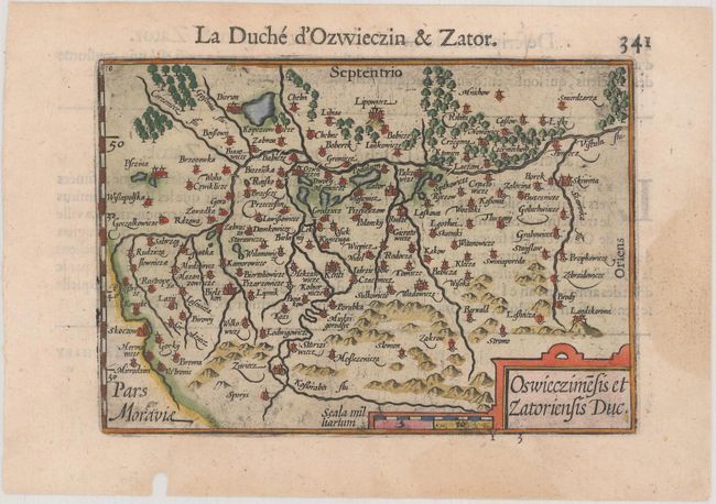
Miniature map depicting the duchies of Oswieczin and Zator in the southern part of Poland, with the Vistula River running across the top of the map. The crisply engraved map is filled with place names each symbolized by a tiny castle. French text on verso.
The map was first published by Cornelius Claesz and printed by Barent Langenes in the 1598 edition of the popular Map-treasury. For the 1599 edition, graduation lines and latitude numerals were added to one side of the border on most of the maps, which were again used for multiple editions through 1650. This is the second state with the added graduation lines from a French edition, printed by Albert Hendricks.
References: King (2nd ed.) pp. 80-82; Van der Krogt (Vol. III) #1940:341.
Condition: A
A dark impression on a bright sheet with a light damp stain in the right blank margin and a worm hole in the bottom blank margin.