Subject: Poland
Period: 1600 (published)
Publication: Thresor de Chartes
Color: Hand Color
Size:
4.9 x 3.4 inches
12.4 x 8.6 cm
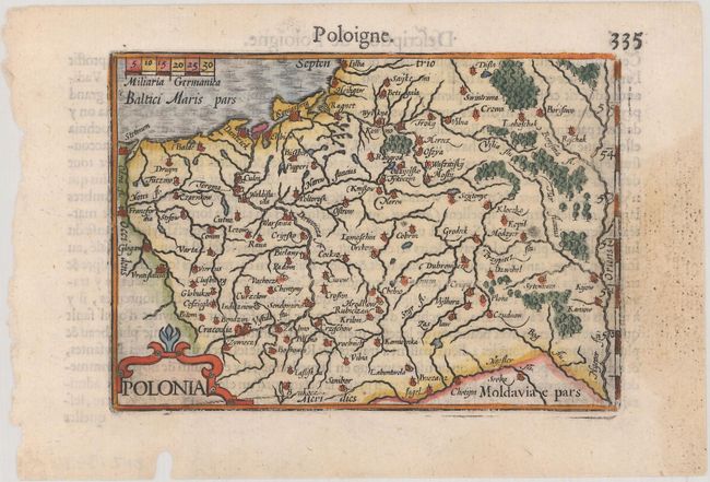
A miniature map of Poland, extending east to Kiev, Ukraine along the Dnieper River (Nijepper flu.). The map is filled with information on towns and rivers. Embellished with a decorative cartouche and a moire-patterned sea. French text on verso.
The map was first published by Cornelius Claesz and printed by Barent Langenes in the 1598 edition of the popular Map-treasury. For the 1599 edition, graduation lines and latitude numerals were added to one side of the border on most of the maps, which were again used for multiple editions through 1650. This is the second state with the added graduation lines from a French edition, printed by Albert Hendricks.
References: King (2nd ed.) pp. 80-82; Van der Krogt (Vol. III) #1900:341.
Condition: A
A dark impression on a bright sheet with a light damp stain barely entering the image at right and a worm hole in the bottom blank margin.