Subject: Northern France, Paris
Period: 1598-1750 (circa)
Publication:
Color:
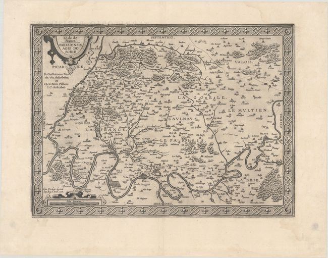
A. L’Isle de France. Parisiensis Agri Descrip., by Abraham Ortelius, from Theatrum Orbis Terrarum, dated 1598, black & white (18.2 x 13.3"). Superb map of the region with Paris and Vincennes attributed to Francois de la Guillotiere. It is beautifully engraved with forests, cities, villages and rivers with the compounds at Vincennes and Madril prominently shown. The map is embellished with two strapwork cartouches and is surrounded in a bold interlocking border. Spanish text on verso, published in 1602. References: Van den Broecke #41. Condition: A dark impression on a bright sheet with the horn coat of arms commonly found on Ortelius maps and a faint damp stain at right.
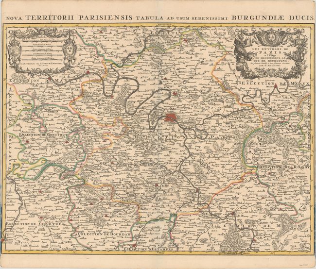
B. Les Environs de Paris, a l'Usage de Monseigneur le Duc de Bourgogne..., by Delisle/Covens & Mortier, circa 1750, hand color (24.1 x 17.8"). This handsomely engraved map illustrates the area surrounding Paris, depicted by a bird's-eye plan at center. Hundreds of towns, political boundaries, rivers, and forests are also shown. A Latin title above the map reads: "Nova Territorii Parisiensis Tabula ad Usum Serenissimi Burgundiae Ducis." Condition: A sharp impression on a bright sheet with full contemporary color and narrow side margins, as issued.
References:
Condition: B+
See description above for details.