Subject: Northwestern France
Period: 1630 (published)
Publication: Atlas Minor
Color: Hand Color
Size:
8 x 5.3 inches
20.3 x 13.5 cm
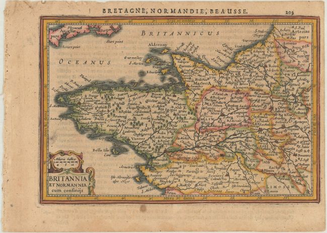
Handsome small map covers Normandy and Brittany with the Channel Islands, centered roughly on Angiers. The map is filled with detail of the rivers, forests and tiny villages and is embellished with a strapwork title cartouche incorporating the distance scale. French text on verso.
This map was re-engraved for Jan Jansson's editions of the Atlas Minor, published in 5 editions between 1628-48. The copperplates for the original Atlas Minor editions published by Hondius were sold to parties in England between 1621-25. Jansson commissioned Pieter van den Keere and Abraham Goos to engrave new plates, which were close copies of the original editions.
References: Van der Krogt (Vol. III) #4001:352.1.
Condition: B+
A nice impression with light toning and damp stains confined to the blank margins.