Subject: Western Europe, Flight Maps
Period: 1934 (dated)
Publication:
Color: Printed Color
Size:
58.4 x 7.8 inches
148.3 x 19.8 cm
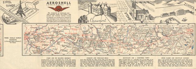
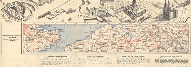
This decorative air route map was published by RaynOil Maps Ltd. for Imperial Airways. Imperial Airways was an early British commercial airline that operated from 1924 until 1939, when it merged into British Overseas Airways Corporation. The pamphlet features three maps covering the London-Paris route, the Paris-Basel-Zurich route, and the London-Brussels-Cologne route. A key on the inner front cover identifies air routes, aerodromes, prohibited areas, frontiers, roads, railways, rivers, and canals. Surrounding the maps are descriptions of various locales, an advertisement for Aeroshell Lubricating Oil, and exquisite illustrations of locations along the routes described, including St. Paul's Cathedral, the Eiffel Tower, and the Palais de Justice in Brussels. The verso features "The Conquest of the Air," "short accounts of the notable efforts which are considered milestones along the road of progress in aviation" with more fantastic illustrations as a border. The back cover advertises the Park Lane Hotel in London and Armstrong Siddeley Motors Ltd. Folds into cardboard covers.
References:
Condition: B+
There is a short tear in the engraving of Le Louquet above the London-Paris route map. Covers have some small chips and edge tears.