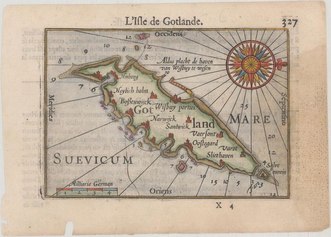
Subject: Gotland, Sweden
Period: 1600 (published)
Publication: Thresor de Chartes
Color: Hand Color
Size:
4.8 x 3.3 inches
12.2 x 8.4 cm
This charming miniature map depicts the island of Gotland, with several towns named throughout. Soundings are noted along the coast, and the map is adorned with a 32-point compass rose orienting north to the right. French text on verso.
The map was first published by Cornelius Claesz and printed by Barent Langenes in the 1598 edition of the popular Map-treasury. For the 1599 edition, graduation lines and latitude numerals were added to one side of the border on most of the maps, which were again used for multiple editions through 1650. This is from a French edition, printed by Albert Hendricks.
References: King (2nd ed.) pp. 80-82; Van der Krogt (Vol. III) #1425:341.
Condition: B+
A dark impression on a bright sheet with a light damp stain at right and a worm hole in the bottom blank margin.