Catalog Archive
Auction 177, Lot 392

"Carte de la Mer d'Allemagne Contenant les Bancs Isles et Costes Comprises Depuis Bergen et les Isles Schetland Jusques au Pas de Calais", Depot de la Marine
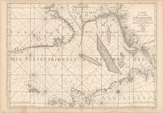
Subject: North Sea

Period: 1774 (circa)

Publication:

Color: Black & White

Size:
33.9 x 24.1 inches
86.1 x 61.2 cm
Download High Resolution Image
(or just click on image to launch the Zoom viewer)

This fine, large sea chart covers the North Sea and Mer de Dannemark (Skagerrak) as well as adjacent coastlines. It includes the Shetland and Orkney islands. There is superb detail throughout, especially of the mud flats of North, East, and West Frisia, the sands in the Channel, and the mouth of the Thames. The chart is oriented with north to the left with two compass roses. Beautifully engraved by Henri van Loon in 1693 and here issued by the Depot de la Marine, with the price (Prix Cinquante Sols) below the title and seal.

References:

Condition: B+

A dark impression on watermarked paper with some light scattered foxing and minor toning along the sheet edges that enters the map image in a couple places at bottom. There are a few short edge tears that have been closed on verso.

Estimate: $500 - $650

Sold for: $340

Closed on 4/29/2020

Archived