Subject: Cartographic Game, England & Wales
Period: 1844 (dated)
Publication:
Color: Hand Color
Size:
18.9 x 23.8 inches
48 x 60.5 cm
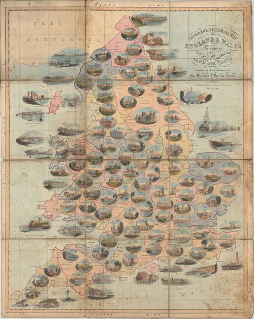
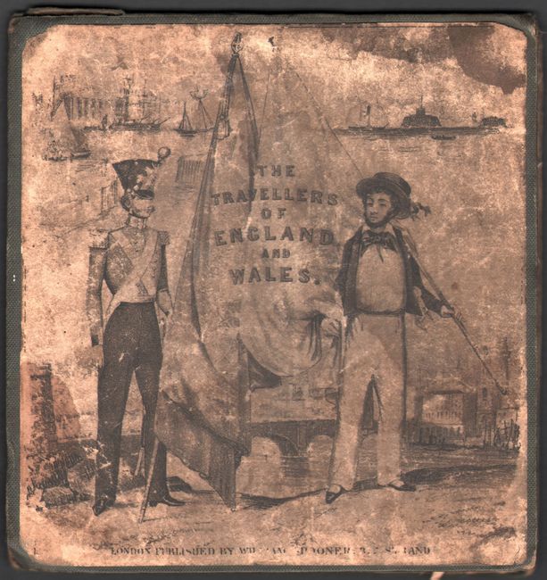
This decorative game map by William Spooner leads players through 104 stops in England and Wales from Berwick-upon-Tweed in the far north along the Scottish border south to London. Surrounding these numbered stops are attractive oval vignettes showing important cities, cathedrals, castles, scenic countryside and more. The game is played with the assistance of an instructional booklet (not present) with descriptive information to further educate its youthful audience on each stop. Dissected and laid on original linen. Folds into original green cloth boards with paper label pasted on the front cover (6.5 x 6.8").
Map games were a popular sideline for cartographic publishers from about 1760 onward in England, with John Bowles publishing the earliest geographical game in 1759. William Matthias Spooner (1796-1882) was a book and print seller, who first began publishing map games in 1836. All of Spooner's games were drawn in a similar pictorial style and well received by the public.
References: cf. Baynton-Williams (The Curious Map Book) pp. 144-45.
Condition: B
Issued folding with light soiling and moderate staining. There are minor edge chips confined to the blank margins. Boards are heavily worn and soiled.