Catalog Archive
Auction 177, Lot 365

"Les Isles Britannicques; ou sont le Royaume d'Angleterre Divise en ses Quatre Roymes des Saxons, Trois des Anglois, et Principte de Galles...", Sanson/Mariette
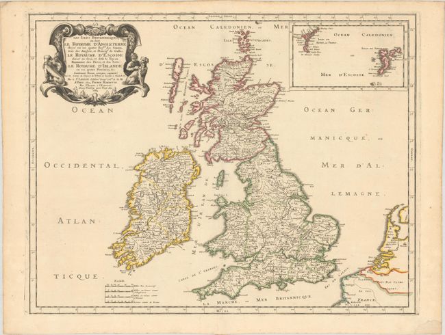
Subject: Britain

Period: 1665 (dated)

Publication: Cartes Generales de Toutes les Parties du Monde…

Color: Hand Color

Size:
20.6 x 16.1 inches
52.3 x 40.9 cm
Download High Resolution Image
(or just click on image to launch the Zoom viewer)

This handsome work is Sanson's second map of the British Isles, updating the distorted projection of his map of 1648. It draws on John Speed, Timothy Pont, and Robert Gordon of Straloch as sources. The map identifies counties and towns and features nice topographical detail. An inset at top right depicts the Faroe and Shetland Islands. The fine title cartouche at top left features men with their hounds. There are four distance scales at bottom.

References: Pastoureau, SANSON V B [116]; Shirley (BI to 1750) Sanson 2.

Condition: A

A crisp impression with contemporary outline color on a sheet with an elaborate coat-of-arms watermark. A small chip in the blank margins at bottom right has been replaced with old paper.

Estimate: $275 - $350

Sold for: $200

Closed on 4/29/2020

Archived