Subject: Britain
Period: 1650 (published)
Publication: Theatre Geographique de France...
Color: Hand Color
Size:
19.4 x 14.6 inches
49.3 x 37.1 cm
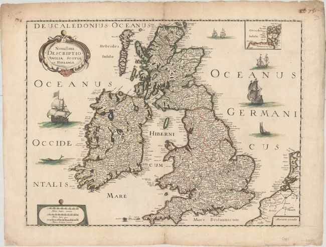
This handsomely engraved map of the British Isles appeared in Mariette's atlas of France and parts of Europe, with only a few contributions from Nicolas Sanson. Shirley compares the engraving style to the delicate work of Matthaus Merian. The map adheres to the outline used by Speed and Hondius and resembles Boisseau's 1644 map of Britain. Political subdivisions are delineated, and towns and cities are named. There is nice topographical detail. Hadrian's Wall is graphically depicted, and ships and a sea monster fill the sea. The Orkney Islands appear in an inset at top right. An ornate title cartouche adorns the top left corner. Three distance scales are enclosed in a cartouche at bottom left.
References: Pastoureau, MARIETTE A [60]; Shirley (BI to 1650) #665; Shirley (BI to 1750) Mariette 1.
Condition: B+
A crisp impression on watermarked paper. There is a 3.5" centerfold separation at top that has been repaired with archival materials on verso, some tiny worm holes that are only visible when held up to light, and some soiling in the margins.