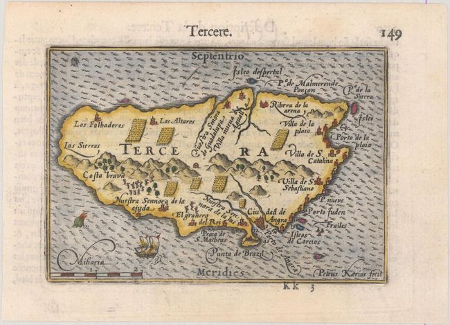
Subject: Azores
Period: 1600 (published)
Publication: Thresor de Chartes
Color: Hand Color
Size:
4.8 x 3.3 inches
12.2 x 8.4 cm
Charming tiny map of this important Atlantic island. The cities, ports, plantations, mountains and forests are all well defined. A tiny ship and sea monster decorate the map. French text on verso.
The map was first published by Cornelius Claesz and printed by Barent Langenes in the 1598 edition of the popular Map-treasury. For the 1599 edition, graduation lines and latitude numerals were added to one side of the border on most of the maps, which were again used for multiple editions through 1650. This is from a French edition, printed by Albert Hendricks.
References: King (2nd ed.) pp. 80-82; Van der Krogt (Vol. III) #6355:341.
Condition: A
A dark impression on a bright sheet with a couple of faint damp stains in the blank margins.