Subject: Peru
Period: 1600 (published)
Publication: Thresor de Chartes
Color: Hand Color
Size:
4.8 x 3.4 inches
12.2 x 8.6 cm
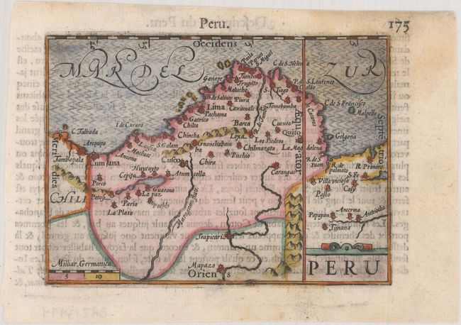
An interesting miniature map of Peru oriented with north at right, and extending into Ecuador, Bolivia and Chile. Major cities and villages are noted, including Quito, Lima, Cusco and La Paz. A simple strapwork cartouche and moire-patterned sea adorn the map. French text on verso.
The map was first published by Cornelius Claesz and printed by Barent Langenes in the 1598 edition of the popular Map-treasury. For the 1599 edition, graduation lines and latitude numerals were added to one side of the border on most of the maps, which were again used for multiple editions through 1650. This is the second state with the added graduation lines from a French edition, printed by Albert Hendricks.
References: King (2nd ed.) pp. 80-82; Van der Krogt (Vol. III) #9820:341.
Condition: B+
A dark impression on a bright sheet with a couple of light stains.