Subject: Amazon River
Period: 1757 (circa)
Publication: Prevost's Histoire Generale des Voyages
Color: Black & White
Size:
14.9 x 6.9 inches
37.8 x 17.5 cm
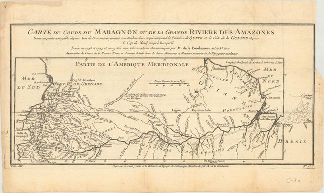
This interesting map is usually referred to as "the first scientific map of the Amazon" as it is based on astronomical observations conducted by Charles-Marie de La Condamine, a French explorer, geographer, and mathematician. After traveling to Ecuador in 1735 to test Isaac Newton's hypothesis that the Earth was not a perfect sphere, La Condamine was unable to travel back to France directly due to insufficient funds. Instead, he traveled eastward down the Amazon River from 1743-44, and performed the first scientific exploration of the great river, including notes on how the natives used curare for poison, and introduced rubber trees to Europe. This map depicts the Amazon River from its mouth in the Atlantic west to its tributaries in Colombia, Peru and Ecuador.
References: Mercator's World (May/June 1999) pp. 18-25.
Condition: B+
A nice impression on paper with a bunch of grapes watermark, issued folding with faint offsetting and marginal soiling. There is a binding tram at right close to the neatline with a tiny tear just entering neatline and repaired with archival tape.