Subject: Guadeloupe
Period: 1759 (dated)
Publication: Hydrographie Francoise
Color: Hand Color
Size:
34.1 x 23 inches
86.6 x 58.4 cm
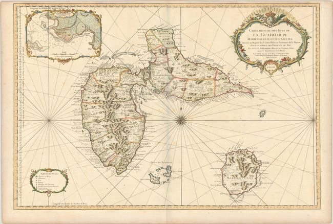
Superb large-scale sea chart with great detail of parishes, forts, towns, settlements, anchorages and topography. Includes Les Saints and Marie Galante. The large inset shows the environs of Fort Louis surrounded in a delicately engraved border. The chart is centered with a large compass rose with radiating rhumb lines and ornamented with title and distance scale cartouches. The meticulous topographical and nautical detail makes this one of the major 18th century maps of Guadeloupe.
References: Phillips (Atlases) #590; Sellers & Van Ee #2010.
Condition: B+
A crisp impression on a sturdy sheet with a double-headed eagle watermark, light scattered foxing, a printer's crease south of Marie Galante, and some creasing along the top edge of the sheet. The faint gray shadow along the centerfold is caused by our scanner and doesn't appear on the map itself.