Subject: Cuba
Period: 1762 (published)
Publication: Universal Museum
Color: Hand Color
Size:
13.5 x 11.6 inches
34.3 x 29.5 cm
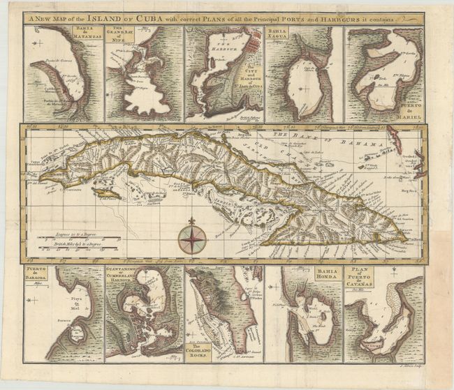
This handsome sheet contains a map of Cuba surrounded by 10 small insets of the principal ports and harbors of the island. The map of Cuba shows towns, roads, rivers and mountains, with some navigational information in the surrounding waters. The inset maps depict Matanzas, Nipe Bay, Santiago de Cuba, Cienfuegos, Mariel, Baracoa, Guantanamo, Cape San Antonio, Bahia Honda, Cabanas.
The Universal Museum was a very short-lived British periodical published between 1762 and 1764. Maps from this publication are rarely seen on the market and we can find no record of this map except in a few institutional collections. It would be an important addition to any Cuban map collection.
References: Jolly #UMUS-9.
Condition: B
A crisp impression on a bright sheet with a large medallion watermark, issued folding and now flattened. A binding trim at right has been replaced with old paper, and a long adjacent binding tear has been archivally repaired.