Subject: Caribbean
Period: 1656 (dated)
Publication: Cartes Generales de Toutes les Parties du Monde…
Color: Hand Color
Size:
21.5 x 15.2 inches
54.6 x 38.6 cm
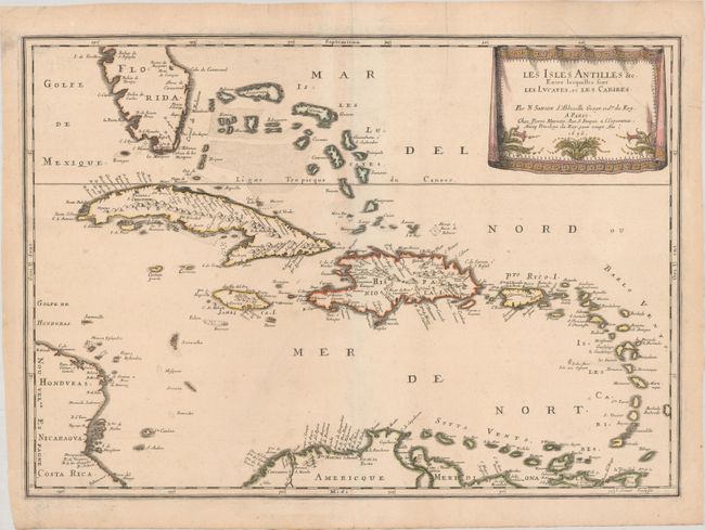
This beautiful map of the Caribbean covers from the tip of Florida to the western coast of Central America and the northern coast of South America. It shows excellent detail of the Bahamas, Cuba, Jamaica, Hispaniola, Puerto Rico, and the Windward Islands. Cape Canaveral, Havana, Santiago de Cuba (S. Iago), Santiago De Los Caballeros (also S. Iago), Santo Domingo, San Juan, Cartagena, and Coro are located along with many other towns and cities. The map is decorated with a delicately engraved, drape-style cartouche. Engraved by Jean Somer.
References: Pastoureau, SANSON V [89].
Condition: A
Watermarked paper with fine original outline color with later color in the cartouche. There is a tiny hole in the upper border and a few minor printer's creases.