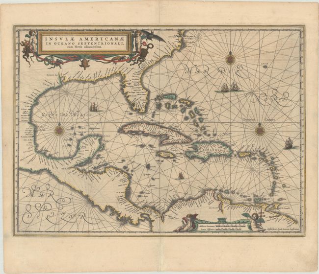
Subject: Gulf of Mexico & Caribbean
Period: 1644 (circa)
Publication: Novus Atlas...
Color: Hand Color
Size:
20.5 x 14.9 inches
52.1 x 37.8 cm
This handsome map focuses on the West Indies and covers the region from the Chesapeake through the Gulf of Mexico, with Central America and the northern part of South America. Details are confined to the coastlines. Cartographically it is based on the extremely rare chart of Hessel Gerritsz from 1631 and is nearly identical to Blaeu's map of the same title. Lovely title and scale of miles cartouches, rhumb lines, compass roses, and sailing ships make this a very attractive map. This is the first state of this map, with German text on verso, published between 1644-58.
References: Burden #248; Van der Krogt (Vol. I) #9600.1.
Condition: A
A dark impression with full contemporary color, very minor offsetting, and archivally repaired centerfold separations at top and bottom, only entering image 1.5" at bottom.