Subject: Southwestern United States & Mexico, Texas
Period: 1852 (dated)
Publication: Meyer's Zeitungs-Atlas
Color: Hand Color
Size:
11 x 8.9 inches
27.9 x 22.6 cm
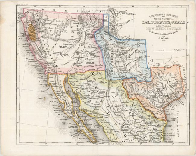
This terrific map covers the western U.S. and northern Mexico. Of special interest is a Gold Region in Northern California, here highlighted in orange. Nueva Helvetia still exists north of Sacramento City. The Southwest and California is called Upper California, and the Baja is Lower California. Lake Tahoe is barely visible and is named Mountain Lake, while the Great Basin is labeled the Great Sandy Plains. Utah is a vague but named area in the northeast portion of Upper California. The Great Salt Lake and Utah Lake are misshapen but correctly located. Mormon City (Salt Lake City) is incorrectly located at the southern tip of the Great Salt Lake. New Mexico is oddly shaped, at the expense of Texas, and contains several towns that properly belong in Mexico; the balance of the border is pre-Gadsden Purchase following the Gila River. Austin's Grant, Houston, Austin, and S. Antonio de Baxar are located in Texas.
References: cf. Wheat (Gold) #217.
Condition: A
There is a small stain and a few short archivally repaired edge tears, all confined to the blank margins.