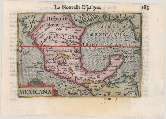
Subject: Southern United States & Mexico
Period: 1600 (published)
Publication: Thresor de Chartes
Color: Hand Color
Size:
4.9 x 3.3 inches
12.4 x 8.4 cm
Charming miniature map of Mexico and the whole coastline of the Gulf of Mexico. The map appears to be based in part on Cornelis de Jode's Americae Pars Borealis (1593). Mexico City is shown prominently, with a smoking volcano just to the south. A number of other cities are labeled in Mexico, while only rivers and capes are noted in the US. The Rio Grande River is identified as R. Escondido. Adorned with a strapwork title cartouche. French text on verso.
The map was first published by Cornelius Claesz and printed by Barent Langenes in the 1598 edition of the popular Map-treasury. For the 1599 edition, graduation lines and latitude numerals were added to one side of the border on most of the maps, which were again used for multiple editions through 1650. This is from a French edition, printed by Albert Hendricks.
References: Burden #114; King (2nd ed.) pp. 80-82; Van der Krogt (Vol. III) #9510:341.
Condition: B+
A dark impression on a bright sheet with a couple of light damp stains.