Subject: Yellowstone, Wyoming
Period: 1883 (published)
Publication: Hayden's 12th Annual Report
Color: Black & White
Size:
28.3 x 31.9 inches
71.9 x 81 cm
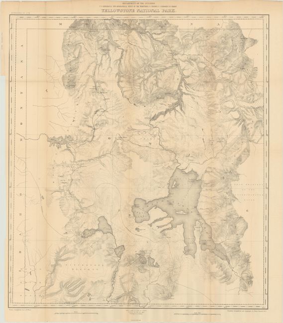
This map was issued in Hayden's 12th Annual Report for 1879, but not published until 1883. It shows the entire park from the Montana state line south to well beyond Yellowstone, Shoshone, Lewis and Heart Lakes, and from the border with Idaho east to the Yellowstone Range and the east fork of the Yellowstone River. Terrific detail of topography with contour intervals at 100 feet, watersheds and numerous features, all at a scale of 1 inch = 2 miles. Names the Upper, Shoshone, Gibbon, and Heart Lake Geyser Basins, Mud Geysers, Mammoth Hot Springs, and much more. Primary triangulation by A.D. Wilson and secondary triangulation and topography by Henry Gannett.
References: Wheat (TMW) #1296.
Condition: A
A clean example, issued folding, with a few tiny splits at the fold junctions.