Subject: Wisconsin
Period: 1869 (dated)
Publication:
Color: Printed Color
Size:
20.5 x 25.6 inches
52.1 x 65 cm
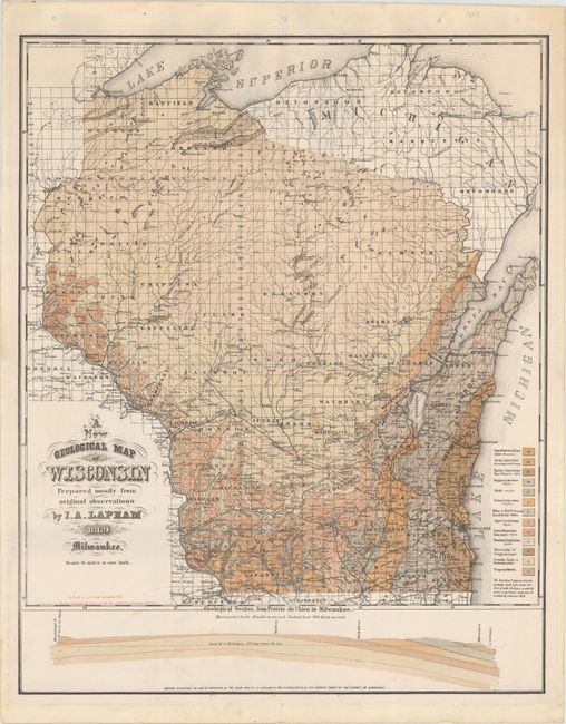
This detailed geological map of Wisconsin was prepared by I. A. Lapham. Drawn on a scale of 15 miles to 1 inch, the map identifies 13 geologic types. Counties, town, roads and railroads are also illustrated. The red lines include figures which indicated the "probably depth in feed below the level of Lake Michigan at which the azoic or primary rocks may be reached by artesian wells." Below the map is a geological cross-section of earth between Prairie du Chien and Milwaukee. Lithographed by Lipman in Milwaukee.
This example was previously owned by Robert Parr Whitfield, a former Curator of geology and invertebrate paleontology at the American Museum of Natural History, whose embossed stamp appears adjacent to the title cartouche.
References:
Condition: A
A sharp, bright example on sturdy paper with minor marginal soiling. The map was previously folded and still has light creases. The previous owner's embossed stamp ("Library of R. P. Whitfield") is adjacent to the title.