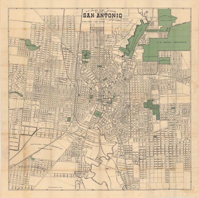
Subject: San Antonio, Texas
Period: 1909 (dated)
Publication:
Color: Printed Color
Size:
25.9 x 25.9 inches
65.8 x 65.8 cm
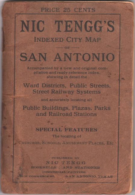
An early detailed map of the city by Nic Tengg showing the street grid pattern, parks, gardens, U.S. Arsenal, Fort Sam Houston, and more. A large section marked "cemeteries" is subdivided by religion (Hebrew, Catholic, Lutheran, etc.) as well as sections reserved for "Negroes" and "Odd Fellows." Loosely folds into printed paper wrappers with 36 pages of accompanying text. There are no past sales records for this edition and only two examples located on OCLC.
References:
Condition: B
Issued folding with some light staining mostly at bottom. There are several small splits at the fold junctions with minute loss of image at one junction at bottom. Paper wrappers have light wear and minor stains.