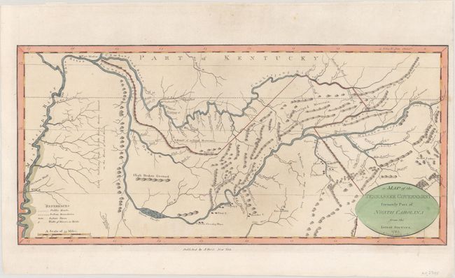
Subject: Tennessee
Period: 1795 (dated)
Publication: The American Atlas
Color: Hand Color
Size:
15.3 x 7.1 inches
38.9 x 18 cm
This significant American map was engraved by Benjamin Tanner and closely copied from General Daniel Smith's map of Tennessee from the previous year. The area depicted extends from the Mississippi River to the headwaters of the Cumberland and Tennessee Rivers. The most prominent features are the rivers, which are well delineated with extensive notations. Indian villages, roads, trails, and early settlements such as Nashville, Clerksville, and Knoxville are all carefully located. A key in the lower left provides symbols for public roads, Indian boundaries, Indian towns, and "Wedth of Rivers in Yards." It presents the most up-to-date depiction of this frontier state that was available at the time. Second state, published in 1796 by John Reid in New York.
References: Wheat & Brun #655.
Condition: A
A nice impression on a clean sheet of watermarked paper.